wellness
Beyond kunanyi: The Hidden Nature Walks Locals Love But Tourists Miss
While visitors queue for the summit track, Hobart residents are quietly escaping into a network of bushland trails most travel guides have never heard of.
How we reported this
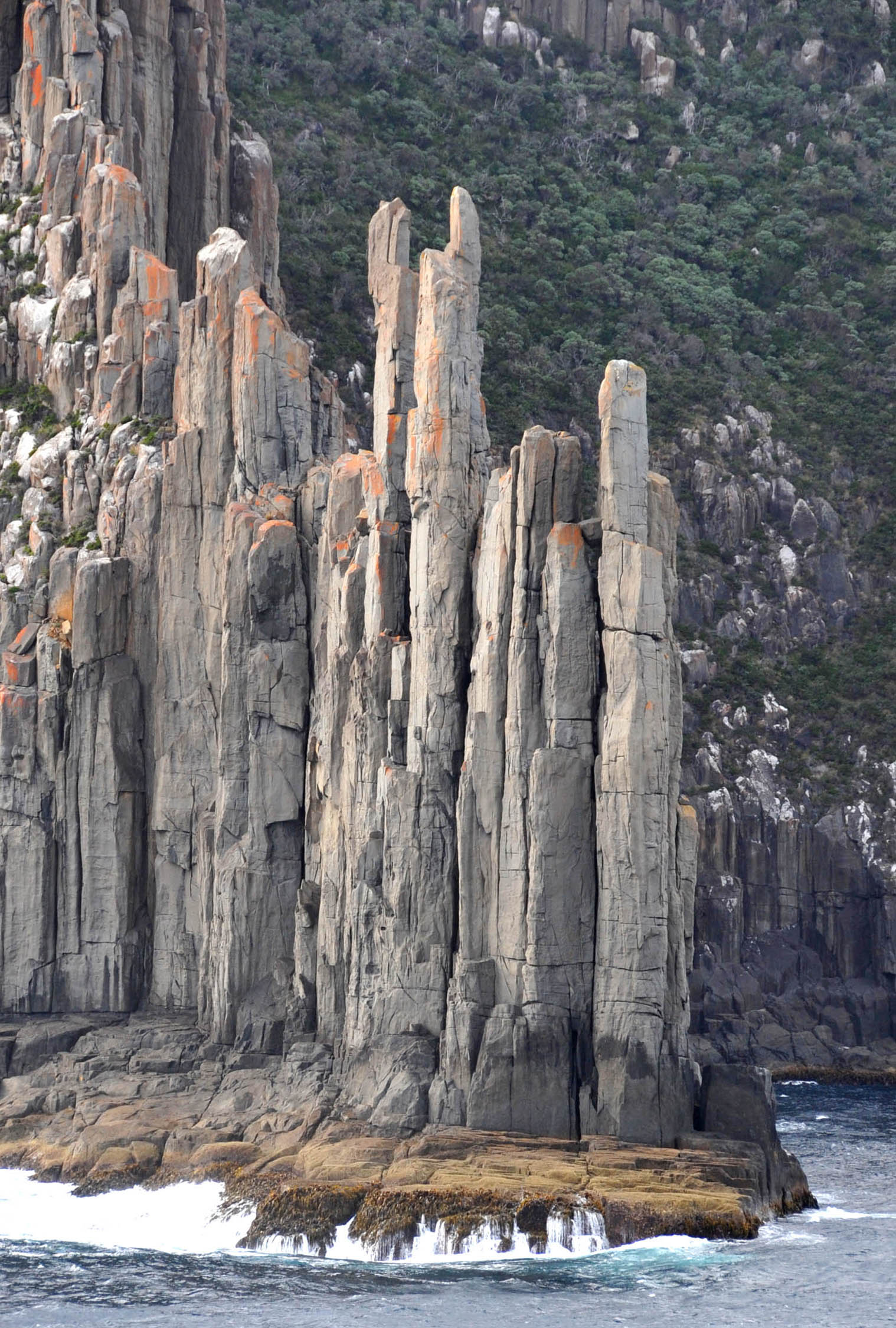
Most Saturdays, the kunanyi/Mt Wellington Pipeline Track draws a small but devoted crowd of Hobart locals who have no interest in sharing it with tour buses. They park along Huon Road, pull on trail shoes, and disappear into a corridor of native bush that runs roughly 11 kilometres across the mountain's southern flank, a route that rarely appears on any visitor itinerary and carries none of the summit-track foot traffic.
Tasmania's outdoor fitness culture has always run deeper than its postcard scenery. With winter days in Hobart averaging around 12 degrees Celsius in July, the city's resident walkers aren't heading indoors, they're finding sheltered gully tracks, ridge-line loops, and foreshore paths that offer genuine solitude within 20 minutes of the CBD. The timing matters: July marks the midpoint of the financial year, a month when many Tasmanians quietly reassess their health habits, and when the state's clean, cold air makes sustained outdoor movement genuinely pleasant rather than punishing.
The Walks That Don't Make the Brochures
Knocklofty Reserve, tucked behind West Hobart on Stanton Crescent, is probably the most underrated 30-minute circuit in greater Hobart. The reserve covers around 62 hectares of dry sclerophyll forest and delivers enough elevation gain on its upper loop to register as a legitimate cardio session. Dog walkers and trail runners from the surrounding suburb of West Hobart treat it as an outdoor gym, cycling through the track network on rotation. There are no entry fees, no booking systems, and on most winter mornings, no crowds.
Further north, the Meehan Range regional reserve near Rokeby, about 15 kilometres from central Hobart, offers a web of fire trails and formed walking tracks that connect through dry eucalypt bush above the eastern shore suburbs. Parks & Wildlife Service Tasmania maintains the reserve's trail infrastructure, and the agency's online trail-finder tool lists several Meehan Range routes graded between 1 and 3 under the national grading system. The Rokeby Hills Loop, roughly 7 kilometres, is a local favourite for its views back toward Ralphs Bay and the Derwent estuary.
The Hobart Waterfront parkrun, held every Saturday morning at 8am along the Cenotaph precinct near Regatta Ground, deserves mention not because it's hidden, by early 2026 it was regularly attracting more than 200 registered participants per event, but because its 5-kilometre course along the Derwent foreshore represents an entry point for people who want structured outdoor fitness without committing to steep mountain terrain. Parkrun is free and open to all fitness levels, and the Hobart event has been running since 2014.
Why Local Knowledge Still Matters
The University of Tasmania's Menzies Institute for Medical Research has produced work over recent years examining the relationship between green space access and mental health outcomes in regional Australian populations. While specific findings vary by study design, the broader body of research consistently points toward regular contact with natural environments as a meaningful factor in reducing psychological stress markers, context that gives Tasmania's abundant accessible bushland a practical, not just aesthetic, significance.
For residents looking to move beyond the familiar, the Parks & Wildlife Service Tasmania website lists more than 60 walking tracks in the greater Hobart region alone, many of them free, open year-round, and graded for moderate fitness. The Springs picnic area on kunanyi, accessible from Fern Tree on Huon Road, serves as the trailhead for several lesser-known routes including the Pinnacle Road alternate and the Organ Pipes Track, both heavily used by locals, both largely absent from mainstream visitor guides.
The practical advice is simple: download the Tasmanian Parks & Wildlife Service trail map before you go, check the current fire and track condition alerts on the PWS website (conditions change quickly in July), and tell someone your route. None of these walks requires specialist equipment. Most require only an hour, sensible footwear, and a willingness to go somewhere the tour groups aren't. For personal health considerations specific to outdoor exercise, speaking with a GP or physiotherapist at a local Hobart clinic remains the right first step.